Hiking to Mont Ouzon
- Level red – hard

 Departure/Arrival
 Point of interest
Presentation
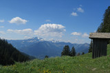
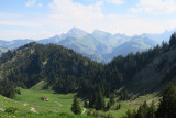
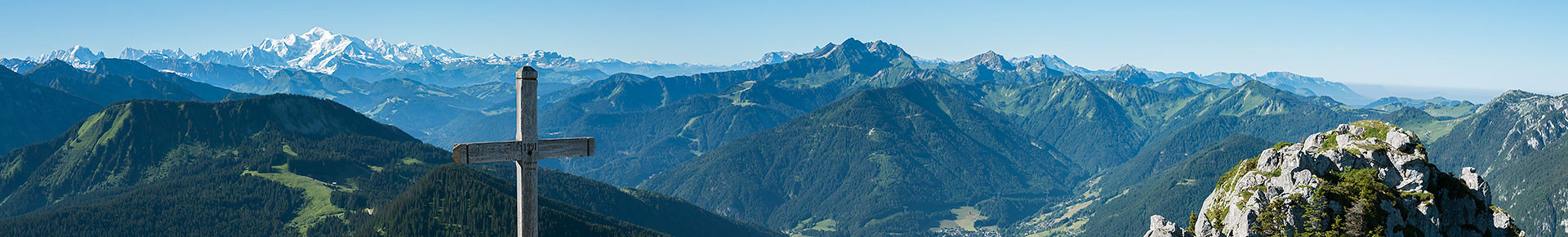
An out-and-back hike to the summit of Mont Ouzon, from where you'll enjoy a magnificent 360° panorama of Lake Geneva to the north, the Mont-Blanc chain and the Swiss Alps to the south, and the Dent d'Oche and Cornettes de Bises to the east.
The hike begins with a forest path, then crosses the alpine pasture past the Chalets d'Ouzon to the Col Plan Champ, then a path climbs gradually until you reach the chain-linked chimney that leads to the summit just above.
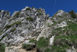
CAUTION: this section is fairly technical and even dangerous for people who are not used to this type of climbing.
Made up of large boulders, the summit is quite aerial without being vertiginous.
CAUTION: this section is fairly technical and even dangerous for people who are not used to this type of climbing.
Made up of large boulders, the summit is quite aerial without being vertiginous.
- Informations Itinéraire :
- 6 km
- 600 m de dénivelé
- 180 minutes
Download